MARC JACOBS
Hutch Post
A fast-moving storm system is set to bring accumulating snow to much of Kansas on Monday, with the heaviest totals expected along the I-70 corridor.
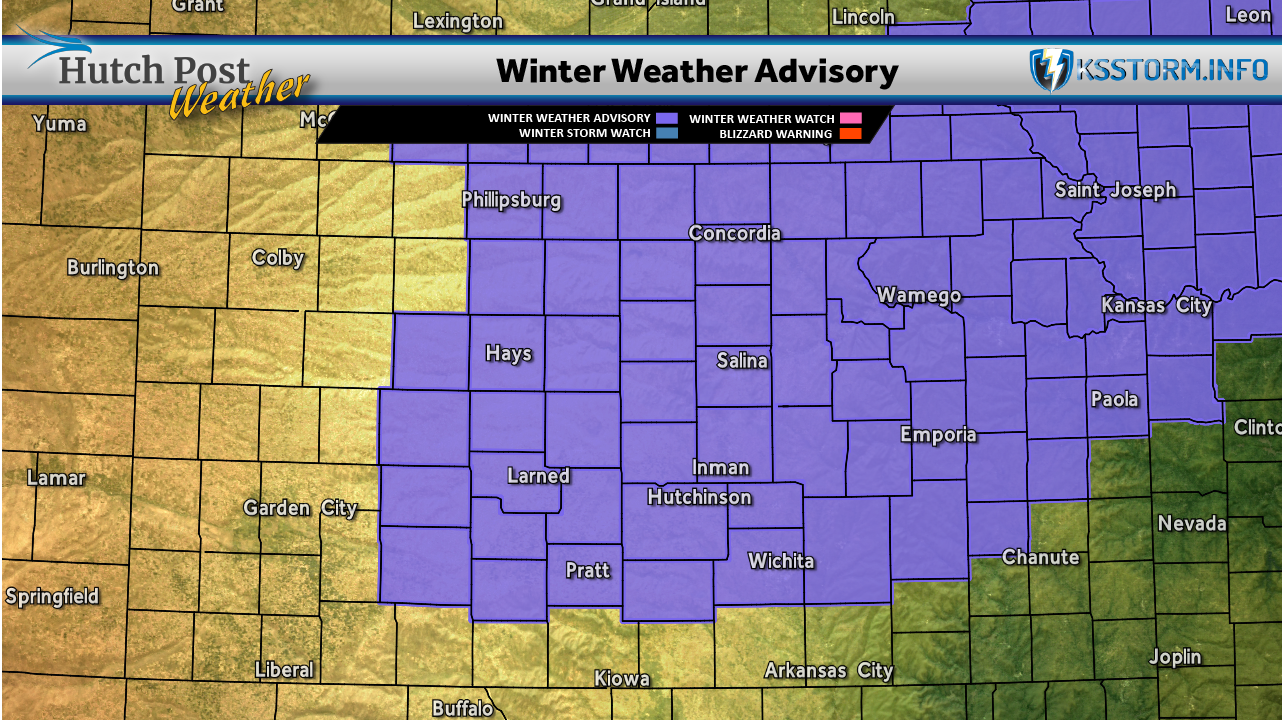
The National Weather Service (NWS) has issued a Winter Weather Advisory through 6 p.m. on Monday. The NWS says to plan on slippery road conditions. The most hazardous conditions will be during the morning hours. This is when the higher snowfall rates are expected which could impact the morning commute.
Click here for KDOT's Kan-Drive map
According to the latest projections by the NWS, 1 to 3 inches of snow are likely for areas along and near I-70, including Russell, Salina and Topeka. NWS forecasters say some localized pockets could see up to 4 inches. Central Kansas communities such as Hutchinson, Emporia and Eureka are forecast to receive 1 to 2 inches, while Wichita, Winfield, Harper and much of southern Kansas may see an inch or less.
LINK: Winter Driving: Hutchinson shop outlines what to check before cold hits
Matthew Harding from our partners at KSStorm.Info tells us that snow will begin this morning with light of moderate snow will developing on Monday with one to three inches of accumulation possible.
Click here for the KSStorm.Info forecast.
Travelers are encouraged to prepare for slick roads, check conditions before heading out, and allow extra time for their morning drive. Winter travel safety guidance includes slowing down, increasing following distance, and avoiding cruise control on snowy roads.