


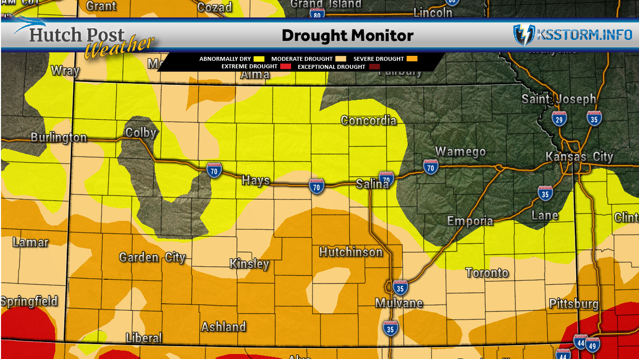
Kansas continues to experience an unusually warm September, with statewide temperatures running well above normal and more than half of the state remaining in drought, according to the latest Kansas Climate Report and Drought Update.
The report, covering the seven-day period ending Sept. 22, shows Kansas has now recorded 30 consecutive days with above-normal average temperatures. That ties a 30-day stretch in March and April 2012. However, cooler weather arrived late in the reporting period, with daytime highs averaging in the 70s from Sept. 20 through Sept. 22.
The statewide average temperature for the week was 75.5 degrees, 7.8 degrees above normal. Through Sept. 22, Kansas' average temperature for the month stood at 79.5 degrees, 9.1 degrees above normal. The current record for the warmest September is 76.7 degrees, set in 1931.
Before the late-week cooldown, temperatures climbed into the 90s. A cooperative weather station near Plainville reached 104 degrees Sept. 18, setting a record high for the date. Salina reached a record 101 degrees the following day.
Rainfall was widespread but uneven. Northeast Kansas received the heaviest precipitation, with portions of Brown, Doniphan and Nemaha counties receiving more than five inches. An observer east of Highland reported 6.47 inches for the week. Heavy rain also fell along the Kansas Turnpike corridor between Wichita and Topeka and in an area stretching from McPherson toward Manhattan and Hiawatha.

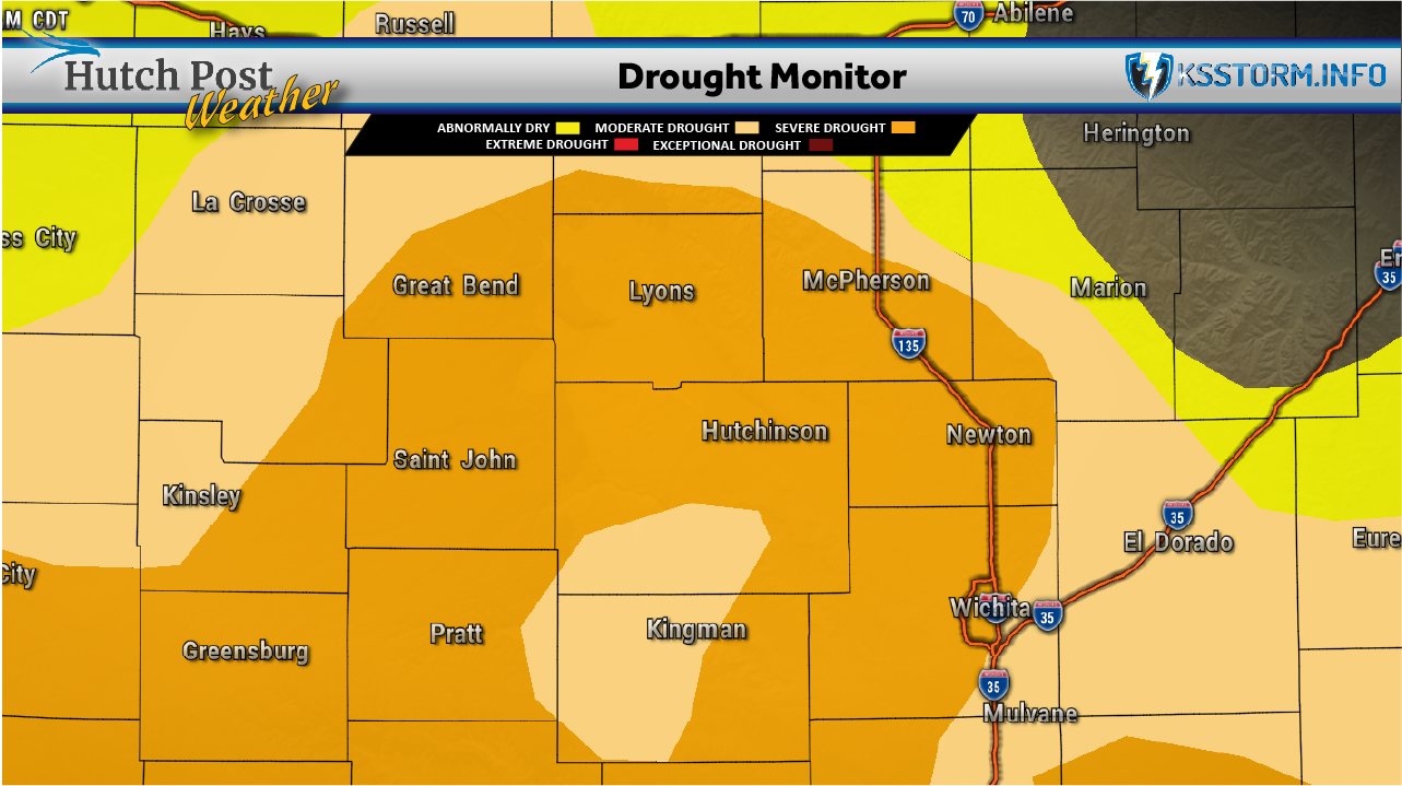
Statewide precipitation averaged 1.09 inches, or 178% of normal for the week. South-central Kansas received an average of 0.95 inches, or 176% of normal. Despite the recent rainfall, south-central Kansas remains the state's driest climate division for the year, running 4.29 inches below normal precipitation.
The rain did result in some drought improvement. More than 30 counties in eastern Kansas improved by one drought category in the Sept. 22 U.S. Drought Monitor. The percentage of Kansas experiencing moderate drought or worse declined slightly from 51.6% to 50.9%. It marked the fourth consecutive week with more than half of Kansas in drought. Meanwhile, the portion of the state considered completely drought-free jumped from 9% to 22.5%.
Additional rainfall could be on the way. The seven-day forecast through Sept. 30 calls for above-normal precipitation statewide, with two to three inches possible in northeast Kansas and generally three-quarters of an inch to 1.75 inches elsewhere.
Temperatures are expected to remain above normal, particularly Sept. 26 and 27, before another modest cooldown. The longer-range outlook for Sept. 30 through Oct. 6 also favors above-normal temperatures and precipitation across Kansas.