Rainfall over the past week brought modest but noticeable improvements to drought conditions across portions of Kansas, although the benefits were far from uniform.
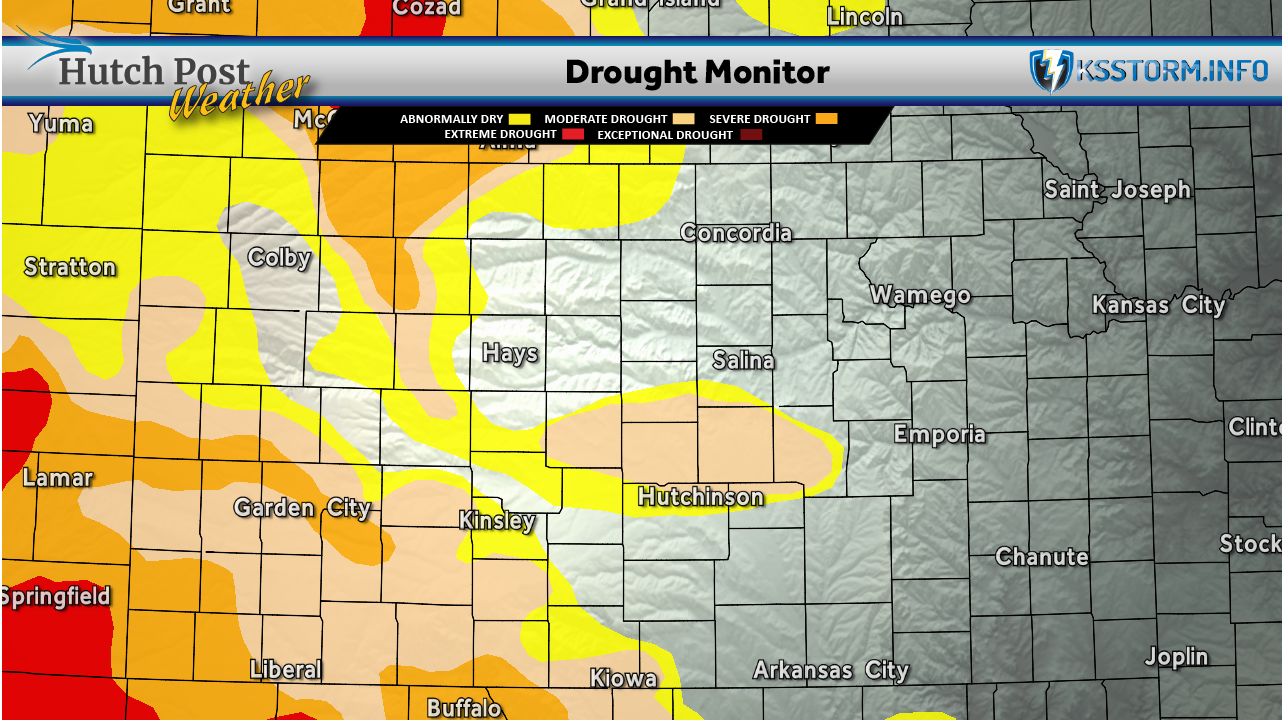
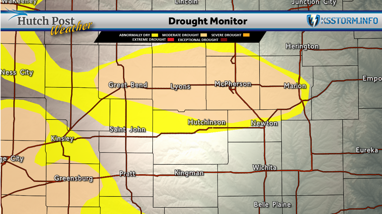
Across central Kansas, including much of the Hutchinson, Lyons, McPherson and Great Bend areas, moderate drought (D1) remained in place. However, the latest map shows abnormally dry (D0) conditions expanding around the edges of the drought area, particularly south of Hutchinson and into portions of Reno, Pratt and Kingman counties. That indicates recent rainfall helped improve soil moisture, but not enough to completely eliminate drought concerns.
Farther west, severe drought (D2) continued across southwest Kansas, but the coverage shrank slightly in some locations where beneficial rainfall occurred. Areas of moderate drought replaced some of the severe drought along the eastern edge of the hardest-hit region.
The greatest drought improvements occurred in north-central Kansas, where several counties saw drought conditions ease following repeated rounds of thunderstorms. Much of eastern Kansas remains free of drought.
Despite these improvements, recent rains were highly localized. Some communities received several inches of rain while neighboring counties saw much less, leaving a patchwork pattern of drought conditions across the state.

The improvements align with last week's widespread thunderstorms that produced heavy rainfall across parts of central and eastern Kansas. However, southeastern Nebraska and portions of western Kansas missed many of those storms, allowing drought impacts to linger.
Overall, this week's U.S. Drought Monitor reflects gradual improvement rather than a major turnaround. Additional widespread rainfall will be needed in the coming weeks to further improve pasture conditions, replenish soil moisture, and reduce long-term drought impacts across central and western Kansas.
The U.S. Drought Monitor is jointly produced by the National Drought Mitigation Center at the University of Nebraska-Lincoln, the United States Department of Agriculture, the National Oceanic and Atmospheric Administration and the National Aeronautics and Space Administration. Map data courtesy of NDMC.