HUTCHINSON, Kan. — Hutchinson Fire continues to put out what remains of the Cottonwood Complex fire that swept through the area on Saturday. Fire Chief Steve beer presented two maps of the areas affected by the fire. Of the 35 homes that were destroyed nearly all of them were in an area from Victory Road to Clydesdale and from 4th north to 17th Avenue.
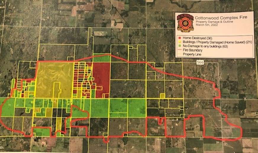
Here are two maps that show where the buildings were damaged or destroyed and the outline of the fire. The second map is a satellite image of the fire and how it spread through the area.
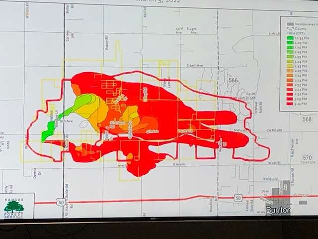
Crews battled along three different fronts during the fire due to wind change which can be seen on the satellite image. The perimeter of the fire stretches about 26.3-miles.
Local photographer Nick Hemphill was able to capture a view of the fire damage from the air.
CLICK HERE to download the HutchPost mobile app.
CLICK HERE to sign up for the daily HutchPost email news update.