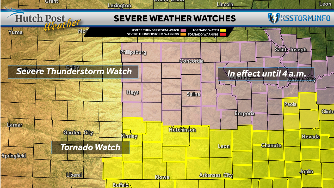
National Weather Service has issued a Tornado Watch for a large portion of south central and southeast Kansas, as severe weather continues to move across the region overnight.
Tornado Watch 155 is in effect until 4 a.m. Monday, replacing part of an earlier watch. The updated alert includes counties across south central and southeast Kansas, including Reno, Sedgwick, Butler, Harvey, Kingman, and Harper counties, along with several counties farther east.
Communities impacted include Hutchinson, Wichita, Newton, El Dorado, Wellington, Arkansas City, Winfield, and Parsons, among others.
Forecasters say conditions are favorable for the development of tornadoes, damaging winds, and large hail, particularly as storms intensify overnight.
At the same time, a separate Severe Thunderstorm Watch (154) remains in effect until 4 a.m. for parts of central Kansas, including Salina, McPherson, Great Bend, and Russell, where strong thunderstorms capable of producing damaging winds and hail are expected.
Residents across the warned areas are urged to:
- Stay weather aware overnight
- Keep multiple ways to receive warnings, including weather radios and mobile alerts
- Have a plan in place to take shelter quickly if warnings are issued
The National Weather Service emphasizes that nighttime storms can be especially dangerous, as tornadoes may be harder to see and warnings may be missed while people are asleep.
Officials recommend identifying a safe shelter area in advance, such as a basement or interior room on the lowest floor of a sturdy building.