



MARC JACOBS
Hutch Post
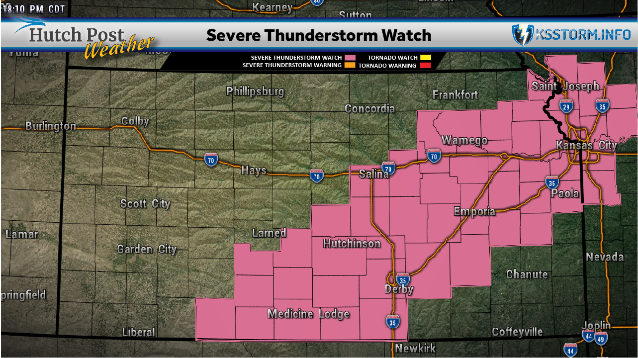
The Storm Prediction Center in Norman, Okla. has issued a severe thunderstorm watch until 11 p.m. this evening.
HUTCHINSON, Kan. — A Severe Thunderstorm Watch is in effect for portions of southern and eastern Kansas Tuesday afternoon and evening as storms capable of producing damaging winds, very large hail and isolated tornadoes develop across the region.
The National Weather Service Storm Prediction Center issued the watch from 4 p.m. until 11 p.m. Tuesday. The watch also includes portions of west-central and northwest Missouri.
Forecasters say scattered thunderstorms are expected to develop and intensify through the late afternoon and early evening hours.
The primary threats include scattered damaging wind gusts, with isolated significant gusts reaching up to 80 mph. Large hail is also possible, with some storms potentially producing hail between 1 and 2.5 inches in diameter.
The Storm Prediction Center said a tornado or two also cannot be ruled out.
Initially, some storms could develop into supercells, which would carry the greatest risk for very large hail and potentially a tornado. Severe multicell thunderstorms are also expected to be possible.
As storms increase in coverage and begin merging during the evening, the primary threat could transition toward damaging straight-line winds as thunderstorm outflows combine.
A Severe Thunderstorm Watch means conditions are favorable for severe thunderstorms in and near the watch area. Residents should continue monitoring weather conditions and be prepared to seek shelter if a Severe Thunderstorm Warning or Tornado Warning is issued for their location.
People should also have multiple ways to receive weather warnings and avoid relying solely on outdoor warning sirens, especially while indoors.
- - - - ORIGINAL STORY
HUTCHINSON, Kan. — Severe thunderstorms could bring large hail, damaging winds and an isolated tornado to the Hutchinson area Tuesday afternoon and night, followed by heavy rain and possible localized flooding into Wednesday morning.
Scott Roberts of KSStorm.info said the entire BW Radio listening area is under a Level 2 of 5 severe weather risk. The main threats are hail up to ping-pong ball size and winds around 60 mph. An isolated tornado cannot be ruled out if a storm remains isolated, Roberts said.
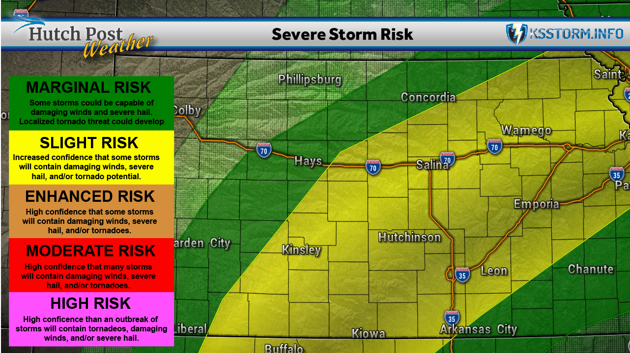
The National Weather Service in Wichita’s Tuesday morning briefing identifies the primary severe weather window as 3 p.m. to midnight, with scattered to numerous thunderstorms expected across central, south-central and southeast Kansas. The weather service lists potential wind gusts of 60 to 70 mph.
The threat is expected to shift toward heavy rainfall Tuesday night into Wednesday morning. Roberts said training thunderstorms — storms repeatedly moving over the same locations — could produce minor flooding.

The weather service forecasts localized rainfall totals of 2 to 4 inches or more, with the greatest potential for heavy rain and flooding generally along and on either side of U.S. 50 south toward U.S. 54 and U.S. 400. That area could expand farther south.
Not everyone will receive excessive rainfall, but the weather service expects the heavy rain threat to begin after about 3 or 4 p.m. and continue well past midnight.
Residents should monitor weather updates and be prepared to move indoors as thunderstorms approach.