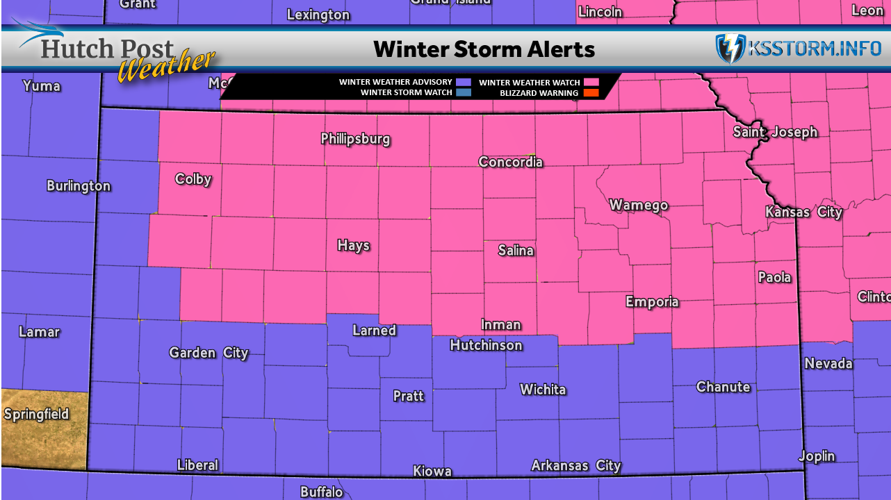
The National Weather Service has issued the following Winter Weather Advisories, Watches and Warnings.
WINTER STORM WARNING IN EFFECT FROM 6 PM TUESDAY TO 6 PM CST WEDNESDAY...
* WHAT... Heavy snow expected. Total snow accumulations between 5 and 8 inches.
* WHERE... Barton, Ellsworth, Lincoln, Russell, and Saline Counties.
* WHEN... From 6 PM Tuesday to 6 PM CST Wednesday.
* IMPACTS... Travel could be very difficult. The hazardous conditions could impact the Wednesday morning and evening commutes.
*PRECAUTIONARY/PREPAREDNESS ACTIONS... If you must travel, keep an extra flashlight, food, and water in your vehicle in case of an emergency. The latest road conditions for the state you are calling from can be obtained by calling 5 1 1.
The latest closings, cancellations and delays
WINTER STORM WATCH IN EFFECT FROM TUESDAY EVENING THROUGH WEDNESDAY AFTERNOON...
* WHAT... Heavy snow possible. Total snow accumulations between 3 and 5 inches possible.
* WHERE... Portions of Central, South Central, and Southeast Kansas.
* WHEN... From Tuesday evening through Wednesday afternoon.
* IMPACTS... Plan on slippery road conditions. The hazardous conditions could impact the Wednesday morning and evening commutes.
PRECAUTIONARY/PREPAREDNESS ACTIONS... Monitor the latest forecasts for updates on this situation.
Governor Kelly issues state of disaster emergency for winter storms
WINTER WEATHER ADVISORY IN EFFECT FROM 6 PM TUESDAY TO 6 PM CST WEDNESDAY...
* WHAT... Snow expected. Total snow accumulations between 1 and 3 inches.
* WHERE... Portions of South Central and Southeast Kansas.
* WHEN... From 6 PM Tuesday to 6 PM CST Wednesday.
If you must travel, keep an extra flashlight, food, and water in your vehicle in case of an emergency. The latest road conditions for the state you are calling from can be obtained by calling 5 1 1.