MARC JACOBS
Hutch Post
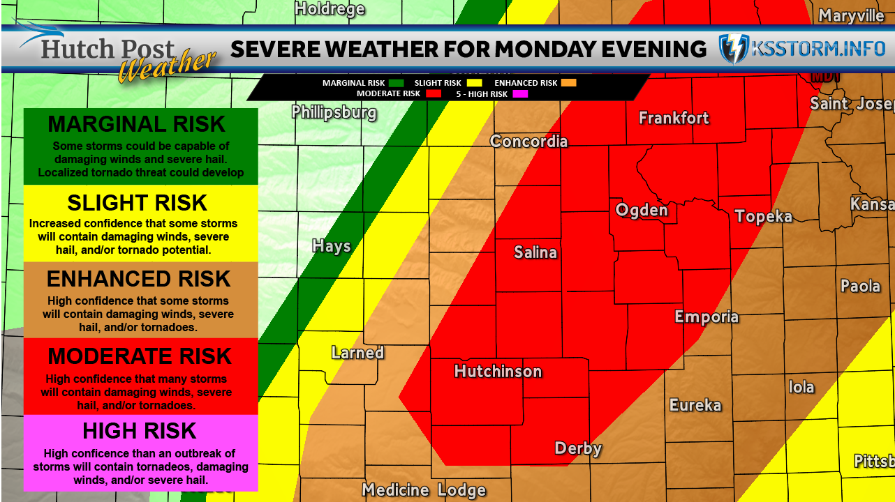
Residents across central and south-central Kansas are being urged to stay weather aware today as forecasters warn conditions are favorable for severe thunderstorms, including the potential for tornadoes, very large hail and damaging winds.
According to our partners at KSStorm.info, a sharp dryline and cold front are expected to trigger scattered thunderstorms beginning around 3 to 4 this afternoon across central Kansas. Storms are then expected to increase in coverage and move south-southeast through the evening and overnight hours.
Forecasters with the National Weather Service say the highest tornado and hail threat will occur through about 8 p.m. While storms remain isolated, some supercells could produce very large hail and possibly strong tornadoes. As the storms begin to merge later this evening, the severe threat is expected to transition more toward damaging straight-line winds, heavy rainfall and a few brief tornadoes.
The National Weather Service says some areas of central Kansas could also experience localized flooding from repeated rounds of storms moving over the same locations.
In addition to the storm threat, strong south winds gusting up to 45 miles per hour are creating very high grassland fire danger west of Interstate 135 today.
Forecasters say additional shower and thunderstorm chances will continue periodically through the middle of the week and into the weekend, although widespread severe weather is not currently expected after today.
Residents are encouraged to closely monitor forecasts and make sure they have multiple ways to receive weather warnings later today and tonight.