A Flood Watch is in effect from 7 a.m. Thursday through late tonight.
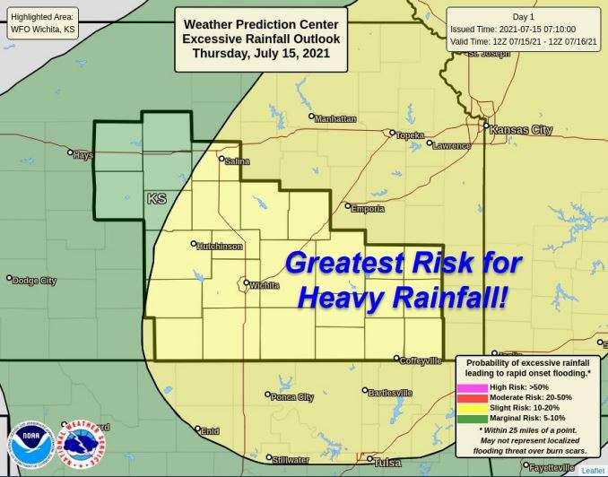
The National Weather Service in Wichita has issued a Flood Watch for Portions of Central, South Central, and Southeast Kansas, including the following areas, in Central Kansas, Chase, Marion, McPherson and Saline.
In South Central Kansas, Butler, Cowley, Harper, Harvey, Kingman, Reno, Sedgwick and Sumner. In Southeast Kansas, Allen, Chautauqua, Elk, Greenwood, Labette, Montgomery, Neosho, Wilson and Woodson.
An approaching disturbance will create widespread thunderstorms, many with very heavy rain, this afternoon. Rainfall rates up to 4 inches per hour are possible. Localized flooding is a strong possibility in the warned areas.
You should monitor later forecasts and be alert for possible Flood Warnings. Those living in areas prone to flooding should be prepared to take action should flooding develop.
Locally heavy rainfall from showers and storms are possible this afternoon through tonight. Additional rainfall amounts of 1 to 2 inches with locally higher amounts possible.
Flooding of lowland areas and of area creeks and rivers are possible. Rainfall rates this high will easily overwhelm city street drainage, and hazardous driving conditions are expected.
Remember, if the street is covered by water, you don’t know if the surface underneath is still there. Turn Around, Don’t Drown.