MARC JACOBS
Hutch Post
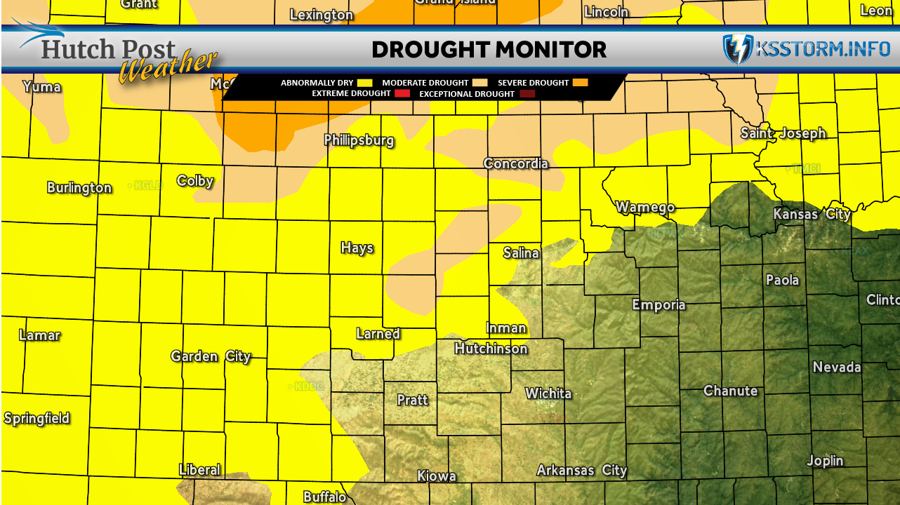
A recent stretch of widespread rainfall and cooler-than-normal temperatures has brought significant drought relief to large portions of the Central and Northern Great Plains, according to the latest drought monitor update.
Between May 20 and June 2, much of Kansas, Nebraska, and northeastern Colorado received between 2 and 4 inches of precipitation, with some areas recording even higher totals. This influx of moisture, coupled with unseasonably cool temperatures during the latter half of May, contributed to notable improvements in drought conditions.
As of June 2 the southern half of Kansas from Pratt County east to the Missouri state line is now officially drought-free.

Elsewhere, more than half an inch of rain fell across southern Colorado earlier this week, prompting a one-category improvement on the U.S. Drought Monitor. Southeastern Wyoming also saw the removal of severe to extreme drought designations, thanks to recent rainfall, long-term precipitation indices (SPI) over 6 to 12 months, and updated drought assessments from the National Drought Mitigation Center (NDMC).
Meteorologists say ongoing monitoring and additional rainfall over the coming weeks will determine whether these trends continue into the summer growing season.
Here are the rainfall totals for selected locations in the area:
• Hutchinson - 2.56"
• Newton - 3.27"
• Wichita - 3.02"
• Kingman - 2.41"
• Pratt - 2.24"
• McPherson - 1.95"
• Wichita - 3.02"
Rainfall totals are for the period ending at 7 a.m. Tuesday morning.
The U.S. Drought Monitor is jointly produced by the National Drought Mitigation Center at the University of Nebraska-Lincoln, the United States Department of Agriculture, and the National Oceanic and Atmospheric Administration. Map data courtesy of NDMC.