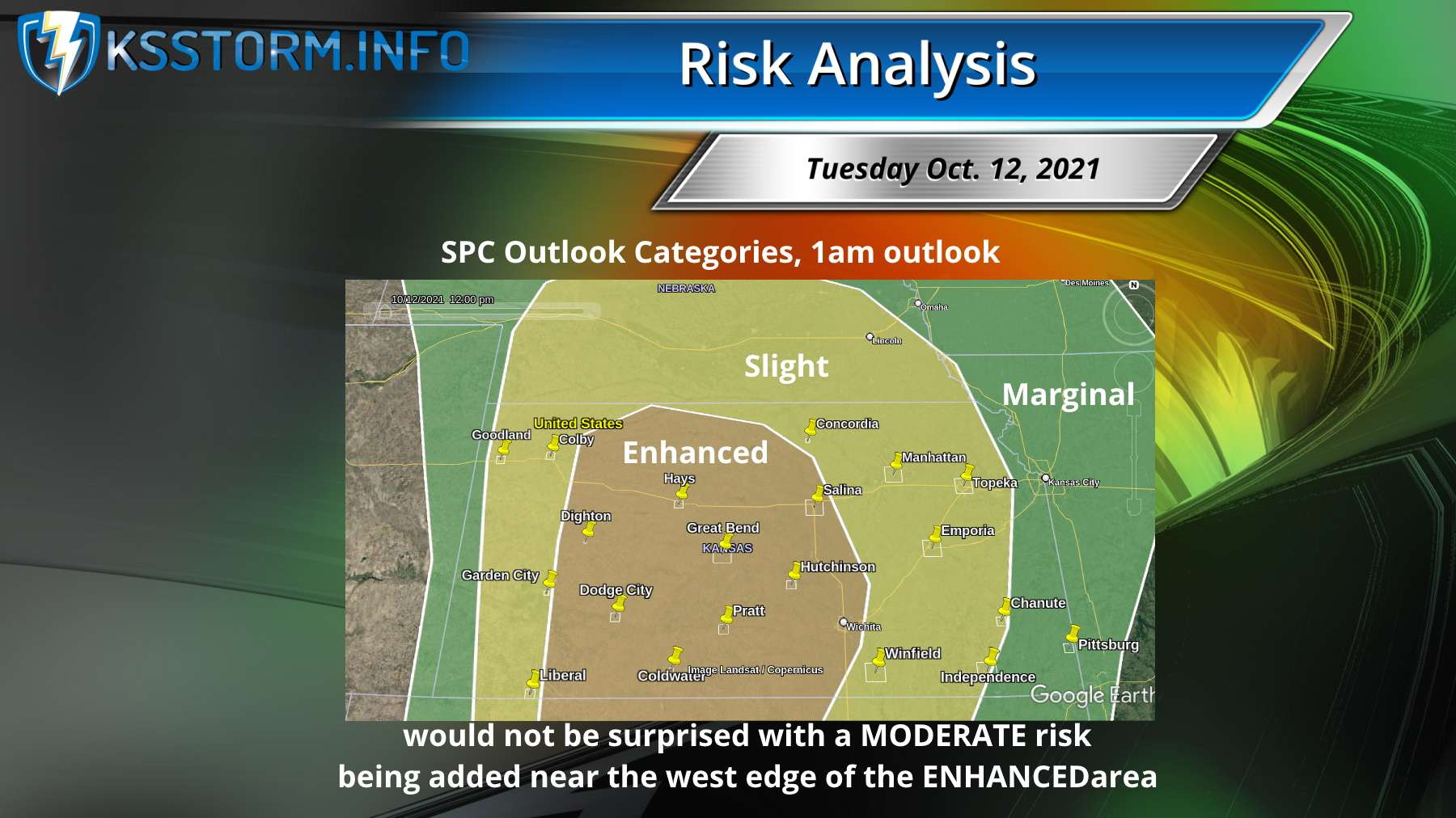
The Storm Prediction Center in Norman, Oklahoma has issued an Enhanced Risk of Severe Weather for about the western half of Kansas Tuesday night into Wednesday morning.
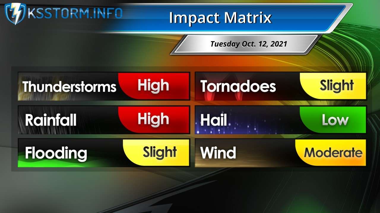
Severe storms will be possible this evening and overnight for areas generally along and especially west of Interstate 135. Golf ball size hail and damaging winds to 70 mph will be the main threats.
According to KSStorm.Info forecaster Scott Roberts, the strength of this low pressure system is once-in-a-decade for this time of year, and the last time we had a significant fall outbreak was in 2015.
This morning, models have pushed the expected dry line formation about 50 miles west, now along a line from Colby to Liberal rather than from Hays to Dodge City.
What this means for Hutchinson is a later arrival and somewhat better chances for a strong line of storms with embedded bowing segments.
The main risk for the Hutch area will be damaging straight line wind.