MARC JACOBS
Hutch Post
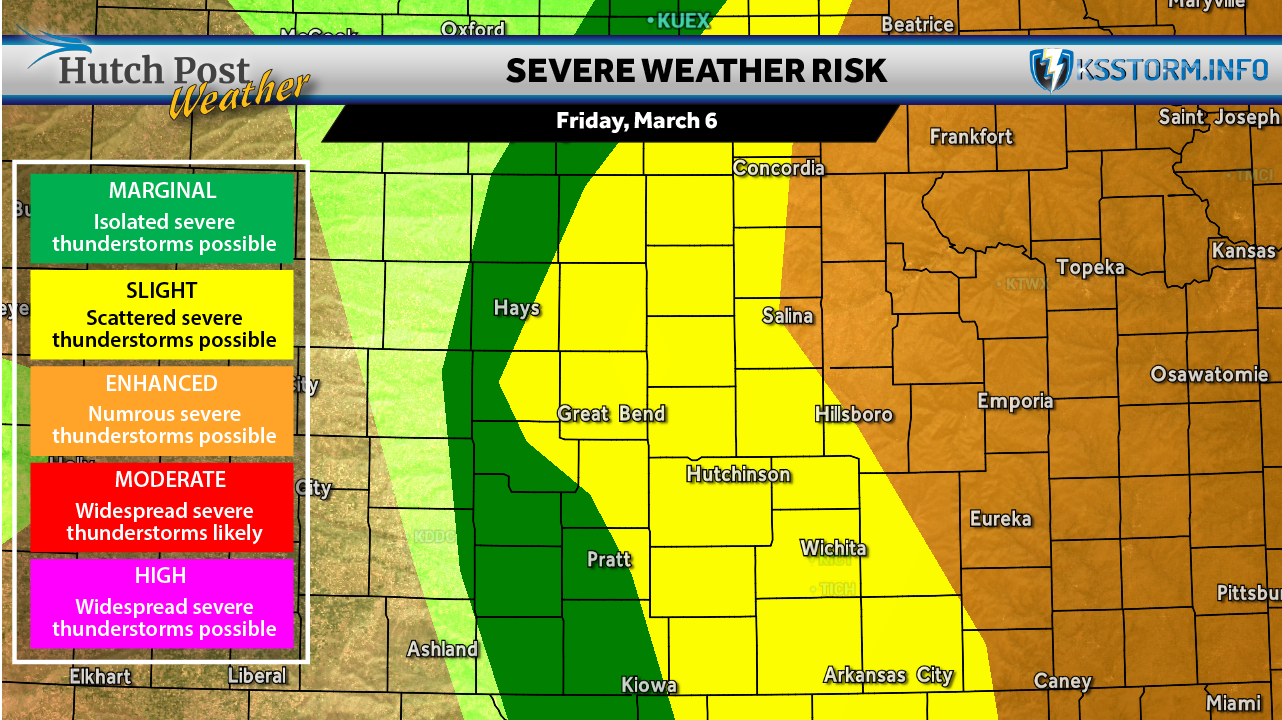
Severe thunderstorms are expected to develop across central Kansas Friday afternoon and evening, bringing the potential for damaging winds, large hail and the possibility of a strong tornado.
Our weather partners at KSStorm.info say scattered severe storms are likely to form across central Kansas, including Hutchinson, Salina and Wichita. Storms are expected to begin developing after about 4 p.m. as a cold front moves southeast through the region.
Potential Hazards
Storms that develop could produce several dangerous conditions, including:
- Damaging winds up to 70 mph
- Large hail up to golf-ball size
- Locally heavy rainfall
- The possibility of a strong tornado
Timing of Storms
The strongest storms are expected to move across central Kansas between about 4 p.m. and 10 p.m., with the potential for severe weather continuing overnight as the storm system tracks southeast.
Areas farther east in Kansas and into Missouri could see storms arrive later in the evening, possibly after 8 p.m.
What Residents Should Do
Emergency officials encourage residents to prepare ahead of the storms by:
- Having multiple ways to receive weather warnings
- Monitoring weather updates throughout the day
- Being ready to move to a safe shelter quickly if warnings are issued
The severe weather threat could last into the early morning hours Saturday as storms continue pushing southeast across the region.