MARC JACOBS
Hutch Post
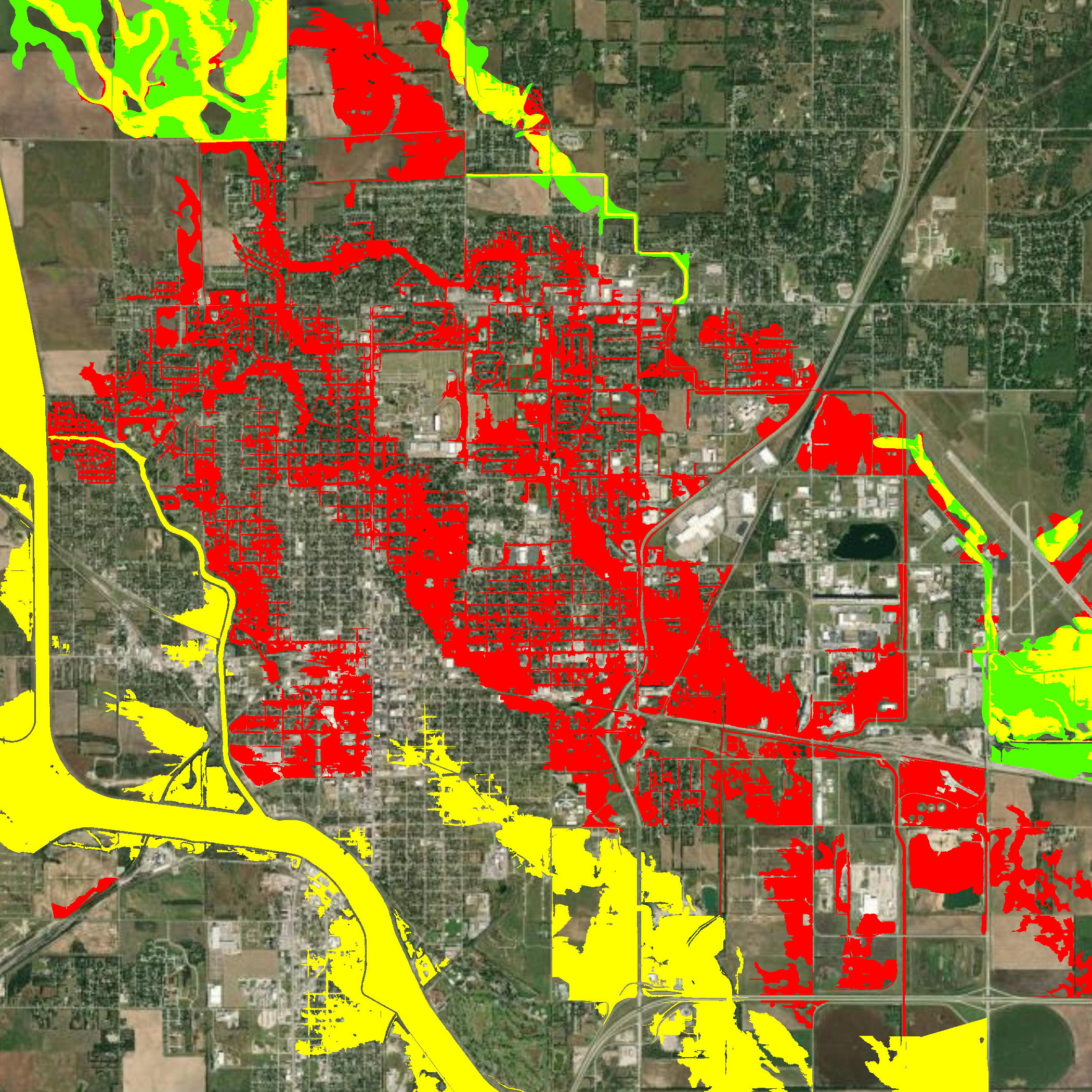
City leaders are working to prepare residents and developers for potential changes to FEMA floodplain maps that could expand regulated flood zones across Hutchinson by 2027.
City Engineer Evan Patterson, who recently presented the draft maps to the Hutchinson City Council, said the update is being driven by new high-resolution LiDAR mapping and improved flood-modeling tools adopted by the State of Kansas. While earlier drafts from June showed even greater impacts, Patterson noted the latest revisions slightly reduce the areas affected.
“The big threat to Hutch is not the river itself — our levee system, certified in 2019, protects against that,” Patterson explained. “It’s our flat terrain and poor drainage that create the real issue. When heavy rains hit, it’s hard to move that water away from homes and businesses.”
Impact on Homeowners
If finalized, the maps would place many more homes in the 100-year floodplain. For homeowners with federally backed mortgages, that could mean a new requirement to purchase separate flood insurance. Patterson warned that standard homeowner’s policies do not cover flood damage.
“Flood insurance can cover both the structure and its contents, so renters should be paying attention too,” he said. “But it’s important to note that groundwater seeping into basements — which we see often near the river — isn’t covered under the federal program.”
Residents who believe their property is inaccurately mapped may apply for a Letter of Map Amendment after obtaining an elevation certificate, which could exempt them from insurance requirements.
Development Challenges
Developers will also face new hurdles. Any project within a mapped floodplain would need to raise structures above the predicted flood level, typically by bringing in fill dirt or using elevated construction. For homes, the required elevation is one foot above the flood level; for critical facilities like schools or police stations, it’s three feet.
That requirement could directly affect Hutchinson USD 308’s proposed new middle school site, which sits in the draft floodplain area. Patterson confirmed the district would need to account for additional costs if the maps are finalized.
City Response
Patterson and City Manager Enrico Vas emphasized that the maps are not final. FEMA’s adoption process will take years, and the earliest implementation would be 2027. In the meantime, Hutchinson is working on drainage improvements to reduce the mapped floodplain footprint.
The city has identified eight smaller projects — including potential detention basins near Cow Creek, Plum Street, and the Farmington neighborhood — that could temporarily store floodwaters without creating permanent ponds. Larger, long-planned projects, such as widening Cow Creek and expanding the State Fair detention basin, remain part of long-term strategies.
“We’re doing everything we can to show FEMA that improvements are being made before these maps are set in stone,” Patterson said.
Economic Concerns
Beyond residents, Vas said he is worried about the city’s ability to attract businesses and industry.
“When companies look at Hutchinson, they could see higher insurance and building costs if we’re labeled a floodplain community,” Vas said. “That’s why it’s critical we push back, pursue projects, and seek federal support.”
City leaders have already engaged Senator Jerry Moran’s office, which pledged interest in helping address the potential economic and residential impact.
What’s Next
The state mapping team will meet with Reno County communities this week to collect comments. Draft maps will then be posted online for public review. Final adoption will not occur until funding and review are complete, leaving time for Hutchinson’s planned projects to influence outcomes.
Patterson urged residents not to panic, but to stay informed.


