
We are within 24 hours of a winter storm coming to Kansas and the cold air is already here. In the end, the cold air will likely be worse than the snow we are going to get.
In the same format as yesterday, we are going to tell you what we know and don’t know about the ongoing cold and upcoming snowstorm.
Let’s start first with what we know, that it’s going to continue to be absurdly cold this weekend across Kansas. Here are the latest wind chill advisories in place for the next several days:
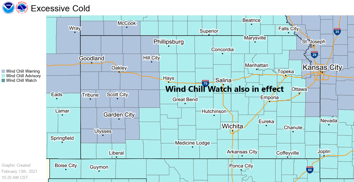
Wind chills for the rest of the afternoon will be in the +5 to -10 range, as winds remain from the northeast at 8-16 mph. Tonight, temperatures will plummet to below zero across Northern Kansas and into the single digits across Southern Kansas as clouds begin to increase from the west and south. Wind chills overnight will range from -10 to -20.
Wind chills Sunday will be in the -15 to -20 range as temperatures remain steady from +5 to -2 degrees.
Temperatures Sunday night fall below zero statewide and could fall to near -10 in Northwest Kansas, wind chills Sunday night will range from -25 to -35.
Scott has written an informative article outlining what you’ll need in your safety kit, should you have to travel the next several days.
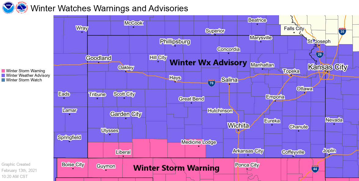
Now for the snowstorm. Here are the current advisory and warning breakdown as of early afternoon:
There is more clarity on the snow forecast from where we were at yesterday, but here is where things stand on what we don’t know and we do know about the upcoming forecast.
What We Don’t Know:
- Amplitude of the wave (positive vs. negative tilt). The ramifications for that are that a more closed off storm would tap into a deeper moisture pool and not move as fast; while a more open system would have less moisture to work with and move quicker
- Does a snowband set up ahead of the main precip area & if so, where does it set up?
- Location of where the heavier bands of snow set up
- Does the snow fall in a large shield or are there dry slots in it?
What We Do Know:
- The impacts from the winter storm will be compounded by intense cold
- Main area of snow develops overnight and continues though daylight hours Sunday, lingering snow showers Sunday night
- Snow will be fluffy, with snow-to-liquid ratios of 20-25:1 for most of the event
- North winds at 10-20 mph will blow and drift the snow, limiting visibilities even after snow is done falling
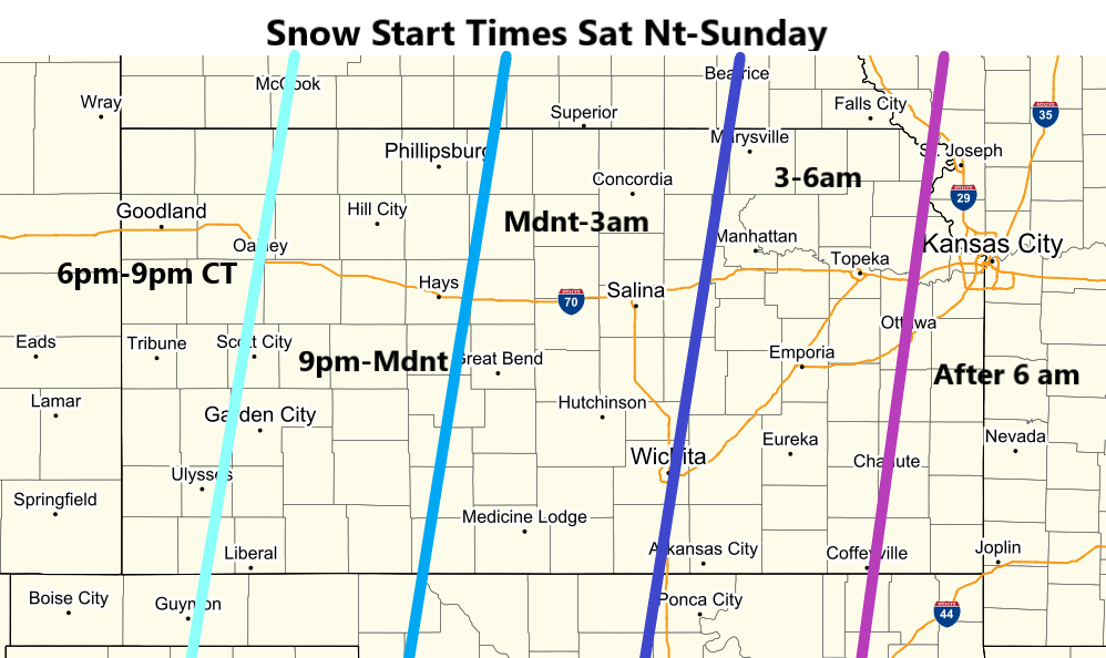
Here is our best guess on when the snow will begin. Find your town on the map and that’s the window where we expect the event to start:
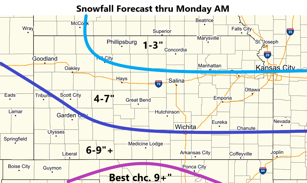
We have been looking at model information through the overnight and morning hours, and have updated the snowfall forecast:
Putting everything together, here is our best guess on where the threats stand from this winter storm:
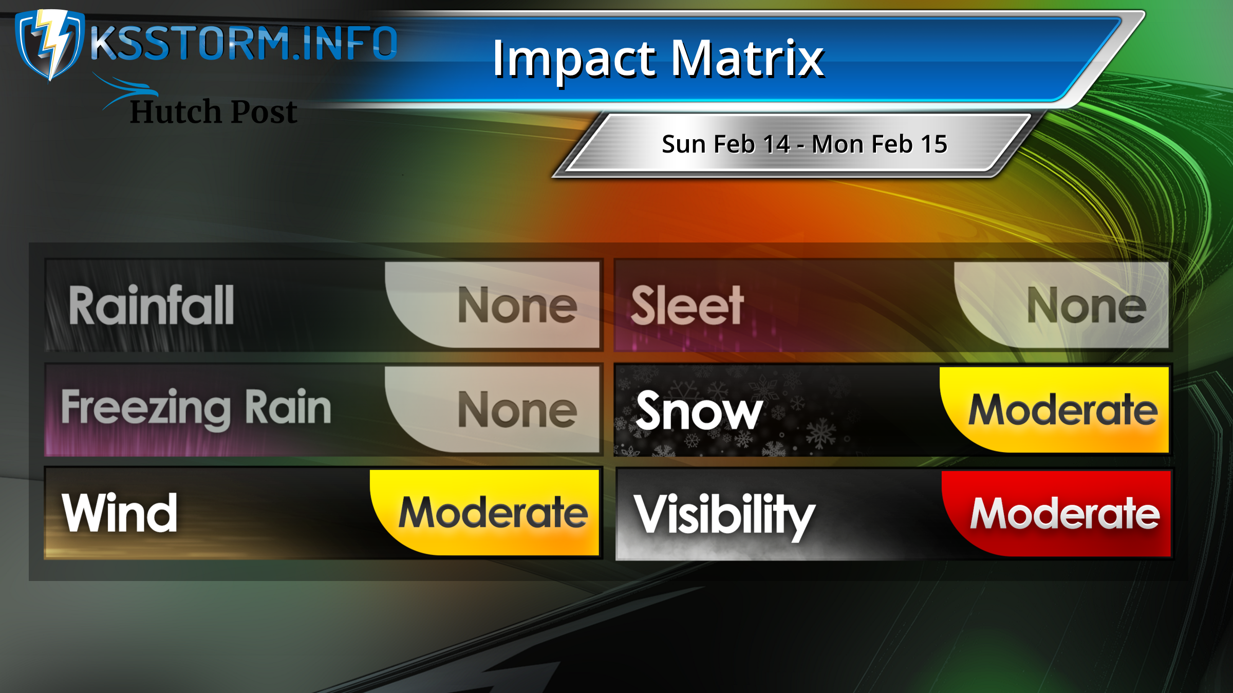
The orange bar Moderate impacts are those which will be of significant inconvenience and travel impact. The red bar Moderate can be read Moderate-to-High, with the higher impacts south and in rural areas. While this isn’t the kind of system that will cause damage to buildings, we expect slick, possibly snow-packed roads, extensive blowing and drifting — especially across east-west roads, and temperature/wind combinations that will make the situation extremely hazardous to life-threatening if you get stuck on the side of the road.
Don’t miss the Facebook Live event this afternoon, with Matt and Mark Bogner. It starts at 2 p.m. on the KSStorm Info Facebook page!