
By NICK GOSNELL
Hutch Post
HUTCHINSON, Kan. — Hutchinson Democratic Rep. Jason Probst is on the committee that will be looking at congressional redistricting maps. One of those maps that was submitted in both houses by representatives from each party and drawn with the help of the League of Women Voters, would divide Reno County between two congressional districts, with the eastern portion of the county in the Fourth District with Wichita and the western portion remaining in the Big First.
"At first I thought, that's kind of weird, we've split the county in half and we've got Hutchinson largely into the Fourth District and the rest the First," Probst said. "My first reaction was well, we should put all of Reno County in the Fourth, but then, as I thought about it, I thought, you know, probably some of the rural areas and smaller towns out in rural Reno County probably identify culturally and economically more with the First District than they would the Fourth District. When I started looking at a different community of interest or a different basis on what you'd use to draw the map, it kind of made sense to me, with a largely agrarian area to the western part of the county and the city of Hutchinson and east is part of that K-96 corridor, the regional economic area partnership, heavily based on industry and manufacturing and technology, so it kind of makes sense that you would put that in the Fourth District."
Though it's almost a mathematical certainty that whatever map is approved will be challenged by someone in court, Probst likes the chances of the so-called Bluestem map, if it were to be the one chosen by the Legislature.
"I think that the League of Women Voters map is relatively unchallengeable," Probst said. "It follows all the guidelines. It's compact. It's as contiguous as can possibly be. It follows the testimony that we heard about keeping the KC metro together. It's a little less snaky and winding than the Ad Astra map."

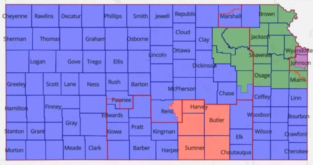
The Ad Astra map appears to be the one with the most initial support from Republican leadership and if the majority party unifies behind it, it would likely pass, but it does carve the city of Lawrence out of the Second District and put it in the Big First, which would seem to be less geographically congruent than the Bluestem map.