MARC JACOBS
Hutch Post
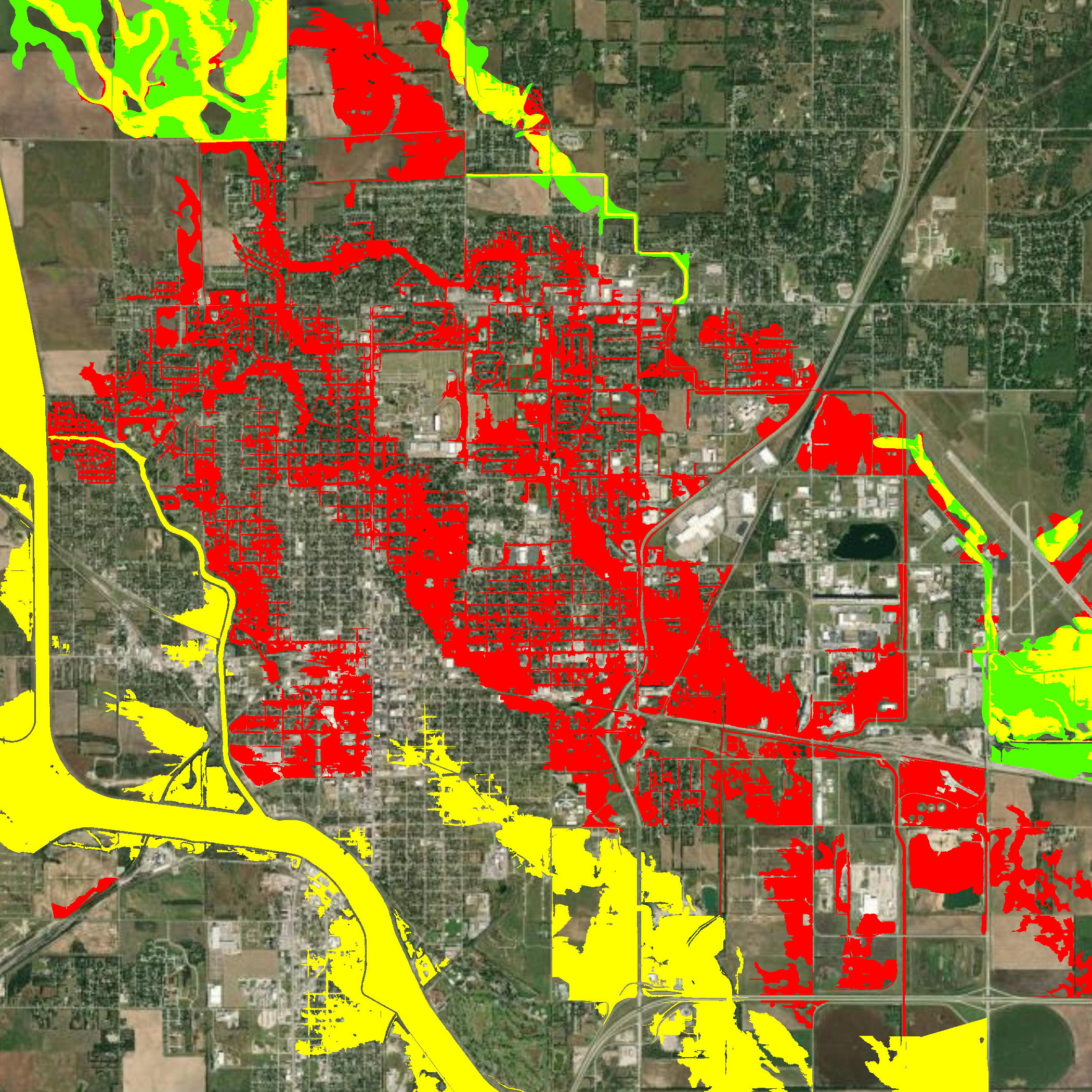
A newly released draft floodplain map could place large sections of Hutchinson into the 100-year floodplain, raising concerns for homeowners, schools, and businesses across the city.
The State of Kansas and FEMA unveiled the draft maps Monday, and City Engineer Evan Patterson presented the findings to the Hutchinson City Council on Tuesday. The new maps reveal broad swaths of floodplain running northwest to southeast through the city, marking a sharp increase from the 2021 maps still in effect.
While the draft maps are a slight improvement over a version issued in June, Patterson said the changes remain significant. If finalized, property owners in the floodplain could face new requirements, including mandatory flood insurance for those with federally backed mortgages. Development in these areas would also require floodplain permits and additional construction standards.
“The earliest the maps could take effect is 2027, but we’re hopeful it will be later,” Patterson said, noting that Hutchinson has time to complete stormwater projects that could reduce the impacted area. The city has identified eight such projects, all of which could be completed by city crews and factored into the final maps.
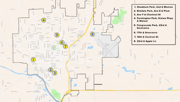
City officials also plan to review the models used to develop the maps, focusing on rainfall data, topography, and especially drainage infrastructure. “Drainage structures are where our review could make the most difference,” Patterson explained, pointing to work already underway on stormwater improvements.
The potential impacts extend beyond homeowners. USD 308’s proposed new middle school sits within the newly mapped floodplain, meaning construction would need to be raised at least three feet above projected water levels—an expensive requirement involving dirt work and site elevation. Existing schools, city facilities, and subdivisions could also face costly adjustments.
City Manager Enrico Villegas told council members he has scheduled discussions with U.S. Sen. Jerry Moran’s office to explore federal funding opportunities to help mitigate the effects.
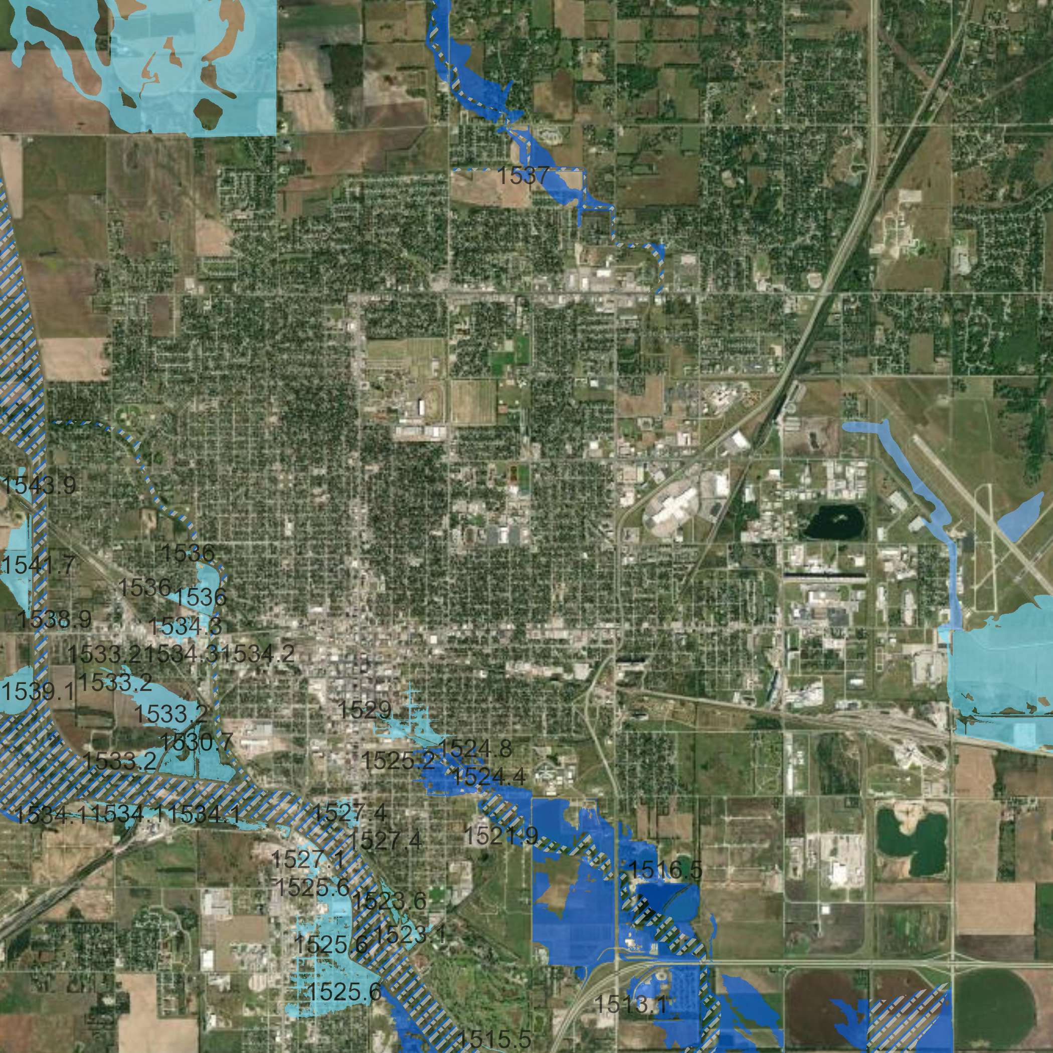
Officials stressed that the flooding risk in question stems not from Cow Creek but from localized rainfall combined with Hutchinson’s flat terrain, limited slope, and a lack of detention ponds. Standing water in streets and yards has long been an issue, and city leaders are weighing solutions such as widening ditches and expanding stormwater capacity.
Some residents may qualify for reduced rates under the National Flood Insurance Program if their homes were built before floodplain designation. Still, Patterson acknowledged it would be a financial burden for many families.
“We’ve essentially bought ourselves about two years,” a city representative said. “Anything we can get done in that time will be factored into the model and could shrink the floodplain.”
City leaders cautioned against opting out of the federal flood program, noting it would make Hutchinson ineligible for federal disaster assistance if flooding occurred.