MARC JACOBS
Hutch Post
Reno County leaders, engineers, and floodplain specialists gathered on Aug. 26, for a Flood Risk Review Meeting to discuss draft updates to the county’s floodplain maps and outline next steps in the years-long mapping project.
The meeting, hosted by the Kansas Department of Agriculture (KDA), WSP USA engineers, and FEMA Region 7, focused on how new flood risk data was developed and the importance of community feedback before maps are finalized.
LINK: Reno County floodplain draft maps
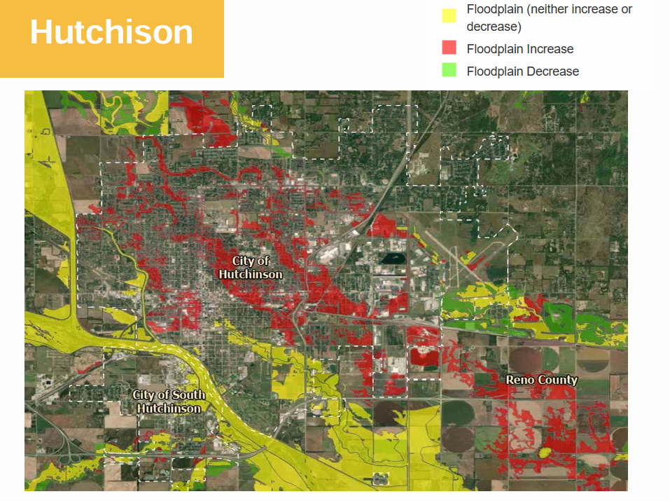
Why New Maps?
Flooding remains the most dangerous weather-related threat in the U.S., and accurate floodplain maps help communities plan development, reduce future damage, and determine insurance requirements. Reno County’s last major updates came in 2010, with partial revisions in 2021 related to levee certifications. Officials said new modeling, aerial imagery, and LiDAR data collected between 2022 and 2025 revealed the need for further revisions.
Key Mapping Updates
The revised draft maps reflect changes in stream paths, drainage areas, and levee conditions across the county:
• Plum Creek was renamed to reflect the GVI drainage ditch, constructed in 2002.
• Cow Creek Tributary C realigned, with portions removed from future maps.
• Cow Creek Tributary A rerouted and renamed the “East Side Storm Drain” following terrain changes near 43rd Avenue.
• Updated Zone AE and Zone A flood models include new analysis, refined land-use data, and surveyed bridge and culvert structures for greater accuracy.
• Accredited levees in Hutchinson, Willowbrook, and South Hutchinson remain recognized, while several smaller levees in Haven, Yoder, Nickerson, and Mount Hope are mapped as “hydraulically insignificant.”
Review and Next Steps
Right now, community leaders are in their comment phase. During this phase they will make notification to the mapping agencies of changes that have been made, or are scheduled that could affect the rainwater runoff. Examples of this are landscaping changes, development of stormwater catch basins or improvements to existing drainage systems.
Once this stage is complete, a public open house will be scheduled where residents can meet with mapping experts, engineers, and insurance specialists to discuss the draft floodplains.
The changes could affect property owners across multiple Reno County communities, including Arlington, Buhler, Haven, Hutchinson, Nickerson, Partridge, Pretty Prairie, South Hutchinson, Sylvia, and Turon. Some properties may be newly included in the floodplain, while others may be removed.
Project leaders emphasized that community participation is crucial:
“This is your opportunity to have an impact,” they stated. “We want to agree on what your map looks like before it enters preliminary status, when changes become much harder to make.”